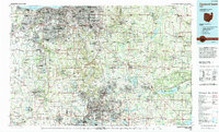
1994 Map of Cleveland South
USGS Topo · Published 1994About this map
The urban and suburban corridors connecting Akron and Cleveland anchor this mid-1990s survey, illustrating the dense residential and industrial expansion across northeast Ohio. Significant green spaces provide a counterpoint to the metropolitan sprawl, notably the Cuyahoga Valley National Recreation Area winding between the two major cities. The map tracks the vital transportation artery of the Ohio Turnpike as it cuts across the glaciated landscape, passing through communities like Parma, Bedford, and Strongsville. To the east and south, the geography shifts toward massive water management and recreation sites including the Michael J Kirwan Reservoir and Berlin Reservoir State Wildlife Area. These features, along with Lake Erie at the northern edge, highlight the region's historical reliance on managed water systems for both industry and public conservation during the late twentieth century.
Find a feature on this map
100 named features on this map. Tap any name to fly to it.
Don’t see what you’re looking for? This feature index may not catch every label — zoom into the map to look around manually.
Map Details
Editions of this 1994 Cleveland South Map
This is the sole edition of this map. No revisions or reprints were ever made.
Other maps of this area

1901 · Oberlin
USGS Topo · 1:62,500

1901 · Massillon
USGS Topo · 1:62,500

1901 · Canton
USGS Topo · 1:62,500

1901 · Wooster
USGS Topo · 1:62,500

1901 · Euclid
USGS Topo · 1:62,500

1902 · Berea
USGS Topo · 1:62,500

1903 · Massillon
USGS Topo · 1:62,500

1903 · Wooster
USGS Topo · 1:62,500

1903 · Cleveland
USGS Topo · 1:62,500

1903 · Canton
USGS Topo · 1:62,500