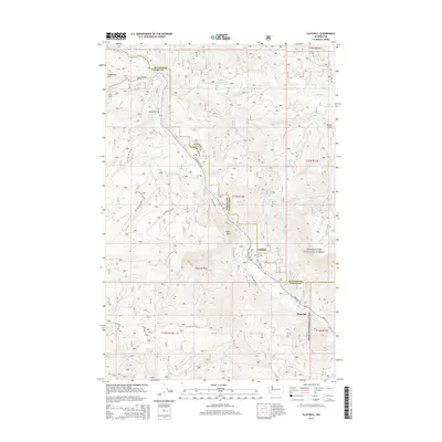
2014 Map of Cliffdell
USGS Topo · Published 2014About this map
The Naches River and its various forks dominate this 2014 terrain study, carving through the high country where Snoqualmie National Forest spans the border between Kittitas and Yakima counties. The confluence of the Little Naches River and Bumping River marks a primary hydrologic junction in the northwest, feeding the main river channel that flows southeast past Sawmill Flat and the community of Cliffdell. This area serves as a gateway for mountain travel, defined by the winding path of State Hwy 410.
Find a feature on this map
44 named features on this map. Tap any name to fly to it.
Don’t see what you’re looking for? This feature index may not catch every label — zoom into the map to look around manually.
Map Details
Editions of this 2014 Cliffdell Map
This is the sole edition of this map. No revisions or reprints were ever made.
Other maps of this area

1897 · Mount Stuart
USGS Topo · 1:125,000

1899 · Ellensburg
USGS Topo · 1:125,000

1901 · Ellensburg
USGS Topo · 1:125,000

1901 · Snoqualmie Pass
USGS Topo · 1:125,000

1902 · Mount Aix
USGS Topo · 1:125,000

1902 · Mount Stuart
USGS Topo · 1:125,000

1903 · Snoqualmie
USGS Topo · 1:125,000

1904 · Mt Aix
USGS Topo · 1:125,000

1950 · Yakima
USGS Topo · 1:250,000

1957 · Wenatchee
USGS Topo · 1:250,000