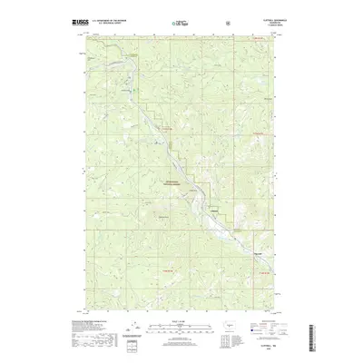
2020 Map of Cliffdell
USGS Topo · Published 2020About this map
The Naches River and Little Naches River converge in this mountain landscape, carving a corridor for the Chinook Pass Highway to wind through the Snoqualmie National Forest. The settlement of Cliffdell serves as a central point along Gold Creek, where the Peterson Cem provides a genealogical touchstone for the local community. Further downstream, the small residential area of Pinecliff sits along the river bend, while upstream at Sawmill Flat, the Bumping River meets the Naches system.
Find a feature on this map
46 named features on this map. Tap any name to fly to it.
Don’t see what you’re looking for? This feature index may not catch every label — zoom into the map to look around manually.
Map Details
Editions of this 2020 Cliffdell Map
This is the sole edition of this map. No revisions or reprints were ever made.
Other maps of this area

1897 · Mount Stuart
USGS Topo · 1:125,000

1899 · Ellensburg
USGS Topo · 1:125,000

1901 · Ellensburg
USGS Topo · 1:125,000

1901 · Snoqualmie Pass
USGS Topo · 1:125,000

1902 · Mount Aix
USGS Topo · 1:125,000

1902 · Mount Stuart
USGS Topo · 1:125,000

1903 · Snoqualmie
USGS Topo · 1:125,000

1904 · Mt Aix
USGS Topo · 1:125,000

1950 · Yakima
USGS Topo · 1:250,000

1957 · Wenatchee
USGS Topo · 1:250,000