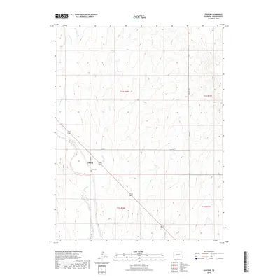
2019 Map of Clifford
USGS Topo · Published 2019About this map
Clifford sits at the intersection of local history and modern transit in Lincoln County, where the wide basin of Big Sandy Creek meets the plains. This area is defined by the drainage patterns of seasonal watercourses like Sevenmile Cr and Coon Cr, which carve through the high plains landscape. The presence of the Clifford Cem just south of the settlement serves as a quiet marker of the community's established roots along the regional road network. While modern thoroughfares like CO Hwy 63 and several county routes cross the terrain, the layout remains largely dictated by the township and range lines of the Public Land Survey System, reflecting the organized agricultural and ranching heritage of eastern Colorado.
Find a feature on this map
15 named features on this map. Tap any name to fly to it.
Don’t see what you’re looking for? This feature index may not catch every label — zoom into the map to look around manually.
Map Details
Editions of this 2019 Clifford Map
This is the sole edition of this map. No revisions or reprints were ever made.
Other maps of this area

1891 · Arroyo
USGS Topo · 1:125,000

1893 · Arroyo
USGS Topo · 1:125,000

1954 · Limon
USGS Topo · 1:250,000

1954 · Lamar
USGS Topo · 1:250,000

1957 · Limon
USGS Topo · 1:250,000

1958 · Limon
USGS Topo · 1:250,000

1958 · Lamar
USGS Topo · 1:250,000
1978 · Kinney Lake
USGS Topo · 1:24,000
1978 · Boyero
USGS Topo · 1:24,000

1978 · Clifford
USGS Topo · 1:24,000