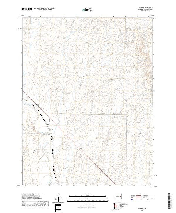
2022 Map of Clifford
USGS Topo · Published 2022About this map
Clifford sits at a geographic crossroads in Lincoln County, where the plains are etched by the winding course of Big Sandy Creek. This 2022 survey captures a quiet prairie landscape defined by a grid of county roads and the convergence of several drainage systems, including Sevenmile Cr and Coon Cr. The presence of the Clifford Cem near the intersection of Co Rd 39 and Co Rd 2p provides a vital point of reference for genealogists and local historians tracing the families who settled this portion of the High Plains. The map's terrain is characterized by subtle elevation changes along the creek beds, showing how the local topography influenced the placement of rural routes like Co Hwy 63 and the sparse settlement patterns that persist into the 21st century.
Find a feature on this map
15 named features on this map. Tap any name to fly to it.
Don’t see what you’re looking for? This feature index may not catch every label — zoom into the map to look around manually.
Map Details
Editions of this 2022 Clifford Map
This is the sole edition of this map. No revisions or reprints were ever made.
Other maps of this area

1891 · Arroyo
USGS Topo · 1:125,000

1893 · Arroyo
USGS Topo · 1:125,000

1954 · Limon
USGS Topo · 1:250,000

1954 · Lamar
USGS Topo · 1:250,000

1957 · Limon
USGS Topo · 1:250,000

1958 · Limon
USGS Topo · 1:250,000

1958 · Lamar
USGS Topo · 1:250,000
1978 · Kinney Lake
USGS Topo · 1:24,000
1978 · Boyero
USGS Topo · 1:24,000

1978 · Clifford
USGS Topo · 1:24,000