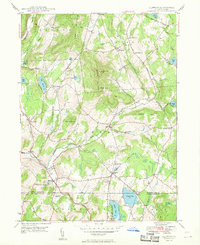
1948 Map of Clifford
USGS Topo · Published 1948About this map
Elk Hill dominates the central landscape of this Susquehanna County region, rising between the headwaters of Tunkhannock Creek and Tinker Creek. The area maintains a classic 1940s rural Pennsylvania character, where small settlements like Clifford and Dundaff are anchored by numerous country churches and family cemeteries. Significant local history is preserved in the road networks, including the historic path of the Newburg Turnpike in the northeast. The southern portion of the map shows a transition toward recreational and social centers at the Susquehanna and Lackawanna county line, notably around Crystal Lake and the Elkview Country Club. These features, alongside smaller water bodies like Lake Idlewild and Newton Lake, illustrate a landscape shifting from its agricultural roots toward a destination for seasonal leisure while maintaining distinct hamlets like Elkdale and Birchtown.
Find a feature on this map
45 named features on this map. Tap any name to fly to it.
Don’t see what you’re looking for? This feature index may not catch every label — zoom into the map to look around manually.
Map Details
Editions of this 1948 Clifford Map
This is the sole edition of this map. No revisions or reprints were ever made.
Other maps of this area

1892 · Honesdale
USGS Topo · 1:62,500

1892 · Dundaff
USGS Topo · 1:62,500

1926 · Starrucca
USGS Topo · 1:62,500

1930 · Starrucca
USGS Topo · 1:48,000

1932 · Susquehanna
USGS Topo · 1:62,500

1933 · Starrucca
USGS Topo · 1:62,500

1935 · Susquehanna
USGS Topo · 1:62,500

1943 · Honesdale
USGS Topo · 1:125,000

1946 · Dalton
USGS Topo · 1:24,000

1946 · Forest City
USGS Topo · 1:24,000