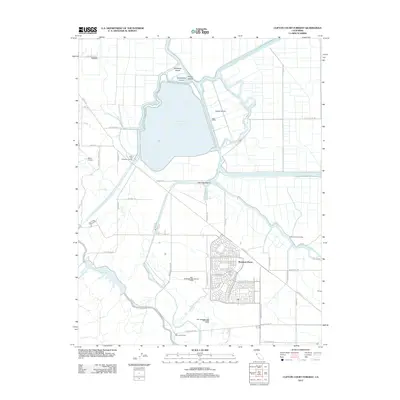
2012 Map of Clifton Court Forebay
USGS Topo · Published 2012About this map
The master-planned community of Mountain House sits at the intersection of water and transit infrastructure in this early 21st-century record of the San Joaquin Valley. The landscape is defined by massive water management projects, including the expansive Clifton Court Forebay and the Bethany Reservoir, which serve as critical nodes for the Governor Edmund G. Brown California Aqueduct and the Delta-Mendota Canal. This network of artificial waterways, including the One Hundred and Twenty Canal, overlays a natural delta environment of sloughs and islands.
Find a feature on this map
58 named features on this map. Tap any name to fly to it.
Don’t see what you’re looking for? This feature index may not catch every label — zoom into the map to look around manually.
Map Details
Editions of this 2012 Clifton Court Forebay Map
This is the sole edition of this map. No revisions or reprints were ever made.
Other maps of this area

1907 · Tesla
USGS Topo · 1:62,500

1911 · Byron Hot Springs
USGS Topo · 1:31,680

1913 · Woodward Island
USGS Topo · 1:31,680

1913 · Holt
USGS Topo · 1:31,680

1914 · Brentwood
USGS Topo · 1:31,680

1914 · Bethany
USGS Topo · 1:31,680

1914 · Union Island
USGS Topo · 1:31,680

1916 · Byron Hot Springs
USGS Topo · 1:31,680

1916 · Byron
USGS Topo · 1:62,500

1916 · Tracy
USGS Topo · 1:31,680