
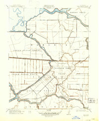
1913 Map of Holt
USGS Topo · Published 1913About this map
Roberts Island and the surrounding delta tracts define this landscape, illustrating the intensive reclamation and agricultural engineering occurring in San Joaquin County during the early twentieth century. The map reveals an intricate network of sloughs and cuts, including Whisky Slough and Burns Cutoff, which weave through named land divisions like the Lower Jones Tract and Drexler Tract. The settlement of Holt serves as a central hub where the Atchison Topeka and Santa Fe railroad crosses the delta. This infrastructure, coupled with numerous landings such as Eldorado Landing and Blackslough Landing, underscores the region's total reliance on both rail and water for transporting goods. Notable local landmarks like Kingston School and a massive Steel Warehouse reflect a growing rural community established upon these reclaimed marshes.
Find a feature on this map
33 named features on this map. Tap any name to fly to it.
Don’t see what you’re looking for? This feature index may not catch every label — zoom into the map to look around manually.
Map Details
Editions of this 1913 Holt Map
2 editions found
Other maps of this area

1894 · Lodi
USGS Topo · 1:125,000

1910 · Castle
USGS Topo · 1:31,680

1910 · Bouldin
USGS Topo · 1:31,680

1910 · Headreach
USGS Topo · 1:31,680

1913 · Woodward Island
USGS Topo · 1:31,680

1913 · Stockton
USGS Topo · 1:31,680

1914 · Bethany
USGS Topo · 1:31,680

1914 · Union Island
USGS Topo · 1:31,680

1915 · Lathrop
USGS Topo · 1:31,680

1916 · Byron
USGS Topo · 1:62,500