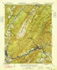
1949 Map of Clifton Forge
USGS Topo · Published 1949About this map
Clifton Forge serves as a vital rail hub where the Chesapeake and Ohio railroad meets the waters of the Jackson River. This late-1940s landscape is defined by the heavy industry of the Rich Patch Mines and the growing municipal centers of Covington and Selma. The map highlights a sharp contrast between the industrial valley and the recreational retreats of the highlands, such as the Cascades Golf Club and Hot Springs to the north.
Find a feature on this map
124 named features on this map. Tap any name to fly to it.
Don’t see what you’re looking for? This feature index may not catch every label — zoom into the map to look around manually.
Map Details
Editions of this 1949 Clifton Forge Map
3 editions found
Other maps of this area

1887 · Lewisburg
USGS Topo · 1:125,000

1891 · Lewisburg
USGS Topo · 1:125,000

1891 · Huntersville
USGS Topo · 1:125,000

1894 · Huntersville
USGS Topo · 1:125,000

1894 · Natural Bridge
USGS Topo · 1:125,000

1894 · Natural Bridge
USGS Topo · 1:62,500

1901 · Monterey
USGS Topo · 1:125,000

1907 · Natural Bridge Special
USGS Topo · 1:62,500

1913 · Eagle Rock
USGS Topo · 1:48,000

1915 · Eagle Rock
USGS Topo · 1:62,500