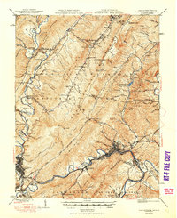
1949 Map of Clifton Forge
USGS Topo · Published 1949About this map
Clifton Forge and Covington serve as the primary industrial and rail hubs along the Jackson River in this 1949 survey. The landscape is defined by the steep ridges of the George Washington National Forest, where the Chesapeake and Ohio RR follows the river's narrow passage through the mountains. To the south, the presence of the Rich Patch Mines near Glen Wilton highlights the region's historical ties to mineral extraction.
Find a feature on this map
142 named features on this map. Tap any name to fly to it.
Don’t see what you’re looking for? This feature index may not catch every label — zoom into the map to look around manually.
Map Details
Editions of this 1949 Clifton Forge Map
3 editions found
Other maps of this area

1887 · Lewisburg
USGS Topo · 1:125,000

1891 · Lewisburg
USGS Topo · 1:125,000

1891 · Huntersville
USGS Topo · 1:125,000

1894 · Huntersville
USGS Topo · 1:125,000

1894 · Natural Bridge
USGS Topo · 1:125,000

1894 · Natural Bridge
USGS Topo · 1:62,500

1901 · Monterey
USGS Topo · 1:125,000

1907 · Natural Bridge Special
USGS Topo · 1:62,500

1913 · Eagle Rock
USGS Topo · 1:48,000

1915 · Eagle Rock
USGS Topo · 1:62,500