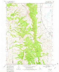
1968 Map of Clifton
USGS Topo · Published 1982About this map
Clifton serves as the primary settlement on the eastern edge of this late-1960s survey, situated along the base of the massive Oxford Ridge and within the Caribou National Forest. The landscape is dominated by the steep western slopes of the forest, where high points like Old Baldy Peak, Weston Peak, and Buck Peak define the horizon. This terrain is carved by numerous drainages, including Clifton Creek, Davis Creek, and Weston Creek, which carry water down from the higher elevations of Clifton Basin and Davis Basin toward the agricultural flats below.
Find a feature on this map
40 named features on this map. Tap any name to fly to it.
Don’t see what you’re looking for? This feature index may not catch every label — zoom into the map to look around manually.
Map Details
Editions of this 1968 Clifton Map

Other maps of this area

1915 · Preston
USGS Topo · 1:96,000

1918 · Preston
USGS Topo · 1:125,000

1954 · Pocatello
USGS Topo · 1:250,000

1955 · Preston
USGS Topo · 1:250,000

1958 · Pocatello
USGS Topo · 1:250,000

1958 · Preston
USGS Topo · 1:250,000

1962 · Preston
USGS Topo · 1:250,000

1968 · Malad Summit
USGS Topo · 1:24,000

1968 · Oxford
USGS Topo · 1:24,000

1968 · Malad City East
USGS Topo · 1:24,000