
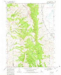
1968 Map of Clifton
USGS Topo · Published 1971About this map
Clifton is positioned at the base of the towering Oxford Ridge, serving as a gateway between the agricultural expanses of the Cache Valley and the high peaks of the Caribou National Forest. This late-1960s landscape is defined by its complex irrigation and drainage systems, featuring the Twin Lakes Canal and the marshy Oxford Slough to the northeast. The terrain is marked by a series of dramatic hollows and canyons, such as Chicken Coop Hollow and North Fork Mine Hollow, which cut through the mountains towards the Oneida and Franklin County border. High-altitude landmarks like Weston Peak and Old Baldy Peak dominate the western skyline, while lower-elevation features like Davis Basin and Clifton Basin indicate the seasonal movement of livestock and water management in this high-desert ranching environment.
Find a feature on this map
39 named features on this map. Tap any name to fly to it.
Don’t see what you’re looking for? This feature index may not catch every label — zoom into the map to look around manually.
Map Details
Editions of this 1968 Clifton Map
Other maps of this area

1915 · Preston
USGS Topo · 1:96,000

1918 · Preston
USGS Topo · 1:125,000

1954 · Pocatello
USGS Topo · 1:250,000

1955 · Preston
USGS Topo · 1:250,000

1958 · Pocatello
USGS Topo · 1:250,000

1958 · Preston
USGS Topo · 1:250,000

1962 · Preston
USGS Topo · 1:250,000

1968 · Malad Summit
USGS Topo · 1:24,000

1968 · Oxford
USGS Topo · 1:24,000

1968 · Malad City East
USGS Topo · 1:24,000