
1968 Map of Malad Summit
USGS Topo · Published 1971About this map
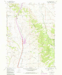
Malad Summit marks a high point of passage through the mountainous terrain of south-central Idaho, where the Bannock Co Oneida Co line traverses high ridges. This 1960s landscape is defined by the headwaters of numerous drainages, including Devil Creek, Birch Creek, and Evans Creek, which carve through the Caribou National Forest. Evidence of small-scale industry and mountain navigation is present throughout the quadrangle, from a Mill and Mine near the northern boundary to a complex network of pack trails and jeep trails providing access to remote springs like Heath Spring and Curly Jack Spring. The map documents a classic Western grazing and watershed landscape, featuring a Radio Facility on a high ridge and the Cherry Creek Campground tucked into the eastern canyons, illustrating the era's balance of resource management and recreation.
Find a feature on this map
39 named features on this map. Tap any name to fly to it.
Don’t see what you’re looking for? This feature index may not catch every label — zoom into the map to look around manually.
Map Details
Editions of this 1968 Malad Summit Map
2 editions found
Other maps of this area

1954 · Pocatello
USGS Topo · 1:250,000

1958 · Pocatello
USGS Topo · 1:250,000

1968 · Oxford
USGS Topo · 1:24,000

1968 · Malad City West
USGS Topo · 1:24,000

1968 · Downey West
USGS Topo · 1:24,000

1968 · Malad City East
USGS Topo · 1:24,000

1968 · Wakley Peak
USGS Topo · 1:24,000

1968 · Clifton
USGS Topo · 1:24,000
1968 · Downey East
USGS Topo · 1:24,000
1968 · Elkhorn Peak
USGS Topo · 1:24,000