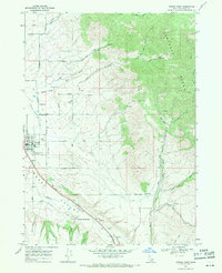
1968 Map of Downey East
USGS Topo · Published 1971About this map
Marsh Valley and the towering Portneuf Range define this landscape in Bannock County, where the valley floor serves as a vital corridor for transportation and settlement. The Union Pacific railroad and Route 91 parallel Marsh Creek as they pass through the community of Downey, which serves as a local hub complete with its Jr High Sch, Hyde Airport, and the Marsh Valley Cem. Further south, the map identifies the geothermal site at Downata Hot Springs, a notable landmark along Evans Road.
Find a feature on this map
47 named features on this map. Tap any name to fly to it.
Don’t see what you’re looking for? This feature index may not catch every label — zoom into the map to look around manually.
Map Details
Editions of this 1968 Downey East Map
2 editions found
Other maps of this area

1915 · Preston
USGS Topo · 1:96,000

1918 · Preston
USGS Topo · 1:125,000

1948 · Bancroft
USGS Topo · 1:62,500

1949 · Bancroft
USGS Topo · 1:62,500

1954 · Pocatello
USGS Topo · 1:250,000

1955 · Preston
USGS Topo · 1:250,000

1958 · Pocatello
USGS Topo · 1:250,000

1958 · Preston
USGS Topo · 1:250,000

1962 · Preston
USGS Topo · 1:250,000

1968 · Malad Summit
USGS Topo · 1:24,000