
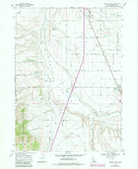
1968 Map of Downey West
USGS Topo · Published 1971About this map
The Union Pacific railroad corridor anchors the agricultural and transport economy of this Idaho valley during the late 1960s. The settlement of Downey serves as a local hub, featuring the Bannock County Fairgrounds and a Substation adjacent to the rail line. Further north, the small community of Virginia is situated along the same transit spine, surrounded by a network of rural roads such as Richards Road and Cunningham Road.
Find a feature on this map
32 named features on this map. Tap any name to fly to it.
Don’t see what you’re looking for? This feature index may not catch every label — zoom into the map to look around manually.
Map Details
Editions of this 1968 Downey West Map
2 editions found
Other maps of this area

1954 · Pocatello
USGS Topo · 1:250,000

1958 · Pocatello
USGS Topo · 1:250,000

1968 · Malad Summit
USGS Topo · 1:24,000

1968 · Oxford
USGS Topo · 1:24,000

1968 · Wakley Peak
USGS Topo · 1:24,000
1968 · Downey East
USGS Topo · 1:24,000
1968 · Elkhorn Peak
USGS Topo · 1:24,000

1968 · Hawkins
USGS Topo · 1:24,000

1968 · Lava Hot Springs
USGS Topo · 1:24,000
1968 · Arimo
USGS Topo · 1:24,000