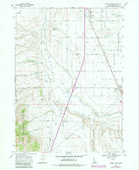
1968 Map of Downey West
USGS Topo · Published 1984About this map
The Union Pacific railroad and the Portneuf Marsh Valley Canal define the eastern valley floor near Downey, providing a glimpse into the agricultural and transportation infrastructure of southern Idaho in the late 1960s. The landscape is a transition from the level basin of Marsh Creek to the rising elevations of the Caribou National Forest in the southwest. Small settlements like Virginia and Shrives are connected by a network of local routes including Richards Road and Tillotson Road.
Find a feature on this map
38 named features on this map. Tap any name to fly to it.
Don’t see what you’re looking for? This feature index may not catch every label — zoom into the map to look around manually.
Map Details
Editions of this 1968 Downey West Map
2 editions found
Other maps of this area

1954 · Pocatello
USGS Topo · 1:250,000

1958 · Pocatello
USGS Topo · 1:250,000

1968 · Malad Summit
USGS Topo · 1:24,000

1968 · Oxford
USGS Topo · 1:24,000

1968 · Downey West
USGS Topo · 1:24,000

1968 · Wakley Peak
USGS Topo · 1:24,000
1968 · Downey East
USGS Topo · 1:24,000
1968 · Elkhorn Peak
USGS Topo · 1:24,000

1968 · Hawkins
USGS Topo · 1:24,000

1968 · Lava Hot Springs
USGS Topo · 1:24,000