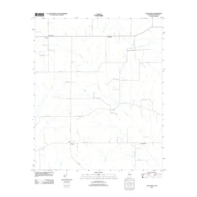
2012 Map of Cliftonville
USGS Topo · Published 2012About this map
Bogue Chitto meanders through this agricultural landscape in Noxubee County, defining the drainage patterns for the surrounding prairie. This modern survey reflects a region deeply rooted in its early rural foundations, with several small settlements scattered across the quadrangle. Deerbrook and Cliftonville anchor the northern reaches, while X-Prairie and Prairie Point occupy the southern portions of the sheet. The network of local roads, many bearing family names like McDavis, Emma Conner, and Johnny Stewart Rd, suggests a long-standing pattern of family landholdings.
Find a feature on this map
44 named features on this map. Tap any name to fly to it.
Don’t see what you’re looking for? This feature index may not catch every label — zoom into the map to look around manually.
Map Details
Editions of this 2012 Cliftonville Map
This is the sole edition of this map. No revisions or reprints were ever made.
Other maps of this area

1953 · West Point
USGS Topo · 1:250,000

1958 · West Point
USGS Topo · 1:250,000

1959 · Artesia
USGS Topo · 1:62,500

1960 · Columbus
USGS Topo · 1:62,500

1963 · West Point
USGS Topo · 1:250,000

1973 · Cliftonville
USGS Topo · 1:24,000

1973 · McLeod
USGS Topo · 1:24,000
1973 · Brooksville
USGS Topo · 1:24,000
1973 · Macon
USGS Topo · 1:24,000
1974 · Dancy
USGS Topo · 1:24,000