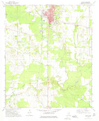
1973 Map of Macon
USGS Topo · Published 1975About this map
Macon serves as the focal point of this 1970s survey, situated along the winding course of the Noxubee River. As the county seat, the town plan is clearly defined by its historic Courthouse, City Hall, and local schools including Central Academy and the High School. The surrounding Noxubee County countryside reveals a dense network of rural spiritual and educational life, with numerous community anchors like Salem Ch, New Zion Ch, and the Reed Attendance Center dotting the landscape.
Find a feature on this map
37 named features on this map. Tap any name to fly to it.
Don’t see what you’re looking for? This feature index may not catch every label — zoom into the map to look around manually.
Map Details
Editions of this 1973 Macon Map
2 editions found
Other maps of this area

1953 · Meridian
USGS Topo · 1:250,000

1953 · West Point
USGS Topo · 1:250,000

1957 · Meridian
USGS Topo · 1:250,000

1958 · West Point
USGS Topo · 1:250,000

1962 · Shuqualak
USGS Topo · 1:24,000

1963 · West Point
USGS Topo · 1:250,000

1963 · Gholson
USGS Topo · 1:24,000

1965 · Meridian
USGS Topo · 1:250,000

1973 · Cliftonville
USGS Topo · 1:24,000

1973 · McLeod
USGS Topo · 1:24,000