
1963 Map of Gholson
USGS Topo · Published 1964About this map
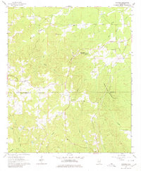
The border between Noxubee and Kemper counties defines this 1963 landscape, where the ridge of Gholson Mountain and White House Mountain separates numerous creek systems. The rural community of Gholson serves as a central hub, surrounded by a network of family-named landmarks and spiritual centers such as Union Hill Ch and Friendship Ch. The area exhibits a pattern of small upland settlements and valley farms, with topography marked by Marsh Hollow and Poorhouse Mountain, the latter being home to both the Poorhouse Spring and Poorhouse Cem. Genealogy researchers will find several small burial sites, including the Van Devender Cem and Pine Turkey Cem, providing a clear record of local settlement history during the early 1960s. The drainage patterns of Running Water Creek and Wahalak Creek illustrate the natural contours that dictated the placement of roads and homesteads across this part of Mississippi.
Find a feature on this map
28 named features on this map. Tap any name to fly to it.
Don’t see what you’re looking for? This feature index may not catch every label — zoom into the map to look around manually.
Map Details
Editions of this 1963 Gholson Map
3 editions found
Other maps of this area

1953 · Meridian
USGS Topo · 1:250,000

1953 · West Point
USGS Topo · 1:250,000

1957 · Meridian
USGS Topo · 1:250,000

1958 · West Point
USGS Topo · 1:250,000

1962 · Lynville
USGS Topo · 1:24,000

1962 · Preston
USGS Topo · 1:24,000

1962 · Shuqualak
USGS Topo · 1:24,000

1963 · West Point
USGS Topo · 1:250,000

1963 · De Kalb
USGS Topo · 1:24,000

1963 · Townsend
USGS Topo · 1:24,000