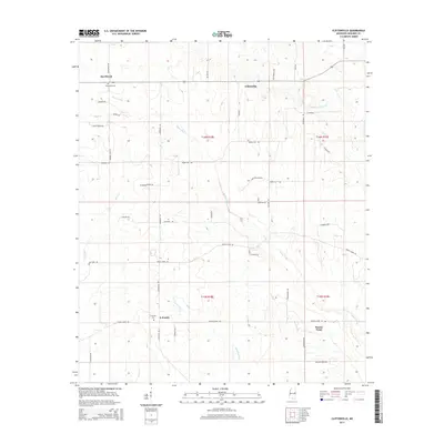
2015 Map of Cliftonville
USGS Topo · Published 2015About this map
Bogue Chitto winds through the heart of this landscape, anchoring a series of rural Mississippi communities including Cliftonville, X-Prairie, and Prairie Point. This region of Noxubee County is characterized by its organized section lines and a network of local roads such as Buggs Ferry Rd and Prairie Point Rd. For those researching family ties, the map identifies specific points of interest like the Deerbrook Cem near the settlement of Deerbrook and the X-Prairie Cem further south. The drainage patterns of Plum Cr and Woodward Cr define the local topography, which transitions between fertile prairie lands and more wooded creek bottoms. The presence of routes like Union Bluff Rd and Ms Hwy 792 reflects the area's agricultural connectivity in the modern era.
Find a feature on this map
51 named features on this map. Tap any name to fly to it.
Don’t see what you’re looking for? This feature index may not catch every label — zoom into the map to look around manually.
Map Details
Editions of this 2015 Cliftonville Map
This is the sole edition of this map. No revisions or reprints were ever made.
Other maps of this area

1953 · West Point
USGS Topo · 1:250,000

1958 · West Point
USGS Topo · 1:250,000

1959 · Artesia
USGS Topo · 1:62,500

1960 · Columbus
USGS Topo · 1:62,500

1963 · West Point
USGS Topo · 1:250,000

1973 · Cliftonville
USGS Topo · 1:24,000

1973 · McLeod
USGS Topo · 1:24,000
1973 · Brooksville
USGS Topo · 1:24,000
1973 · Macon
USGS Topo · 1:24,000
1974 · Dancy
USGS Topo · 1:24,000