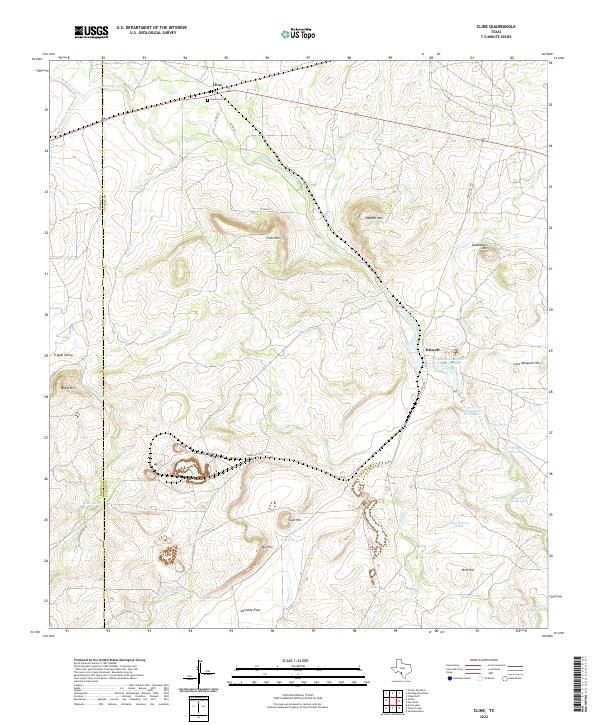
2022 Map of Cline
USGS Topo · Published 2022About this map
Cline and Blewett anchor this southwestern Texas landscape along the border of Kinney and Uvalde counties. The terrain is defined by a series of prominent elevations and ridges, including Cline Mtn, Asphalt Mtn, and Saddleback Mtn, which overlook the seasonal drainages of Turkey Creek and Muela Cr. Industrial history is evident in the presence of the Uvalde Rock Asphalt Company Lake and Whites East Pit, reflecting the area's geological utility. Local genealogy is anchored by Sparks Cem near the northern rail line, while the arid environment is punctuated by vital water sources such as Indian Spring, Golondrina Waterhole, and Dawson Waterhole. These localized water features and named cattle tanks suggest a history of ranching and resource management across the broad stretches of Kennedy Flats and Frypan Valley.
Find a feature on this map
34 named features on this map. Tap any name to fly to it.
Don’t see what you’re looking for? This feature index may not catch every label — zoom into the map to look around manually.
Map Details
Editions of this 2022 Cline Map
This is the sole edition of this map. No revisions or reprints were ever made.
Other maps of this area

1896 · Brackett
USGS Topo · 1:125,000

1897 · Brackett
USGS Topo · 1:125,000

1898 · Uvalde
USGS Topo · 1:125,000

1899 · Uvalde
USGS Topo · 1:125,000

1938 · Turkey Mountain
USGS Topo · 1:48,000

1943 · Turkey Mountain
USGS Topo · 1:62,500

1949 · Cline
USGS Topo · 1:62,500

1954 · San Antonio
USGS Topo · 1:250,000

1957 · San Antonio
USGS Topo · 1:250,000

1958 · Del Rio
USGS Topo · 1:250,000