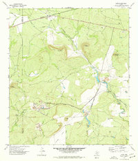
1974 Map of Cline
USGS Topo · Published 1977About this map
Industrial extraction and transit define this landscape along the Kinney and Uvalde county line. The Southern Pacific and Missouri Pacific railroads converge near Cline, a settlement situated north of the prominent Cline Mountain. Further south, the map documents a concentrated area of mining and quarrying activity, including Whites Mine, the Smyth Quarry, and the Gato Quarry. These sites are supported by infrastructure such as a conveyor and a Landing Strip near the small settlement of Dabney.
Find a feature on this map
43 named features on this map. Tap any name to fly to it.
Don’t see what you’re looking for? This feature index may not catch every label — zoom into the map to look around manually.
Map Details
Editions of this 1974 Cline Map
This is the sole edition of this map. No revisions or reprints were ever made.
Other maps of this area

1896 · Brackett
USGS Topo · 1:125,000

1897 · Brackett
USGS Topo · 1:125,000

1898 · Uvalde
USGS Topo · 1:125,000

1899 · Uvalde
USGS Topo · 1:125,000

1938 · Turkey Mountain
USGS Topo · 1:48,000

1943 · Turkey Mountain
USGS Topo · 1:62,500

1949 · Cline
USGS Topo · 1:62,500

1954 · San Antonio
USGS Topo · 1:250,000

1957 · San Antonio
USGS Topo · 1:250,000

1958 · Del Rio
USGS Topo · 1:250,000