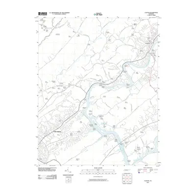
2010 Map of Clinton
USGS Topo · Published 2010About this map
Clinton and Oak Ridge anchor this landscape, where the Clinch River and the expansive Melton Hill Lake define the local geography. The map reveals a dense concentration of family and community history, evidenced by dozens of burial grounds such as the Slave Cemetery, the County Farm Cemetery, and the Jarnigan Chapel Cemetery. This 2010 survey captures the region's industrial and maritime character through the Clinton Marina and several upland mineral extractions like the Jonas Phillips Mine and the Duncan and Coans Mine. Notable landforms like Pilot Knob and Chestnut Ridge frame the valleys, while localized landmarks like the Laurel Grove Lookout Tower and Lupton Cross Roads provide specific points of reference for local historians and genealogists tracing family roots across these ridges.
Find a feature on this map
133 named features on this map. Tap any name to fly to it.
Don’t see what you’re looking for? This feature index may not catch every label — zoom into the map to look around manually.
Map Details
Editions of this 2010 Clinton Map
This is the sole edition of this map. No revisions or reprints were ever made.
Other maps of this area

1893 · Briceville
USGS Topo · 1:125,000

1895 · Loudon
USGS Topo · 1:125,000

1895 · Briceville
USGS Topo · 1:125,000

1896 · Briceville
USGS Topo · 1:125,000

1935 · Bethel Valley
USGS Topo · 1:24,000

1935 · Bearden
USGS Topo · 1:24,000

1935 · Lovell
USGS Topo · 1:24,000

1936 · Duncan Flats
USGS Topo · 1:24,000

1936 · Windrock
USGS Topo · 1:24,000

1936 · Norris Dam
USGS Topo · 1:48,000