
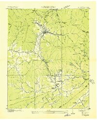
1936 Map of Duncan Flats
USGS Topo · Published 1936About this map
The Tennessee Divide cuts across this 1936 survey, which documents a localized portion of Anderson County along the ridge line. The map focuses on the high terrain separating the Basin from the hollows of Harness Creek and Seeber Cr. This particular sheet is an advance sheet produced through a collaboration between the Tennessee Valley Authority and the U. S. Geological Survey, capturing a moment when the region's geography was being meticulously recorded from aerial photographs. Notable human presence is centered at Duncan Flats, where the Duncan Flats Sch served the small upland community. The inclusion of an Incline near the school suggests local industry or specialized transport necessitated by the steep elevation changes between Low Gap and the surrounding hollows like Lick Hollow.
Find a feature on this map
13 named features on this map. Tap any name to fly to it.
Don’t see what you’re looking for? This feature index may not catch every label — zoom into the map to look around manually.
Map Details
Editions of this 1936 Duncan Flats Map
This is the sole edition of this map. No revisions or reprints were ever made.
Other maps of this area

1893 · Briceville
USGS Topo · 1:125,000

1895 · Briceville
USGS Topo · 1:125,000

1896 · Briceville
USGS Topo · 1:125,000

1936 · Hogbell Gap
USGS Topo · 1:24,000

1936 · Block
USGS Topo · 1:24,000

1936 · Jacksboro
USGS Topo · 1:24,000

1936 · Windrock
USGS Topo · 1:24,000

1936 · La Follette
USGS Topo · 1:48,000

1936 · Norris Dam
USGS Topo · 1:48,000
1936 · Petros
USGS Topo · 1:24,000