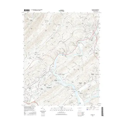
2016 Map of Clinton
USGS Topo · Published 2016About this map
The Clinch River winds through this 2016 survey, defining the industrial and residential boundaries between the cities of Clinton and Oak Ridge. The landscape is a series of ridges and hollows, where long-standing family settlements like Leinarts and Marlow are interspersed with modern developments like Emory Valley and Edgewood Heights. Cultural history is exceptionally well-documented through a dense concentration of burial sites, including the Slave Cem and Jarnigan Chapel Cem, alongside newer landmarks such as Anderson Memorial Gardens. The southern portion of the map is dominated by the waters of Melton Hill Lake and the prominent heights of Pilot Knob. Significant transportation infrastructure is represented by the CSX rail lines and the historic grid of Jackson Square, illustrating the region's evolution from rural hollows like Beartree Hollow to a critical center for science and industry.
Find a feature on this map
238 named features on this map. Tap any name to fly to it.
Don’t see what you’re looking for? This feature index may not catch every label — zoom into the map to look around manually.
Map Details
Editions of this 2016 Clinton Map
This is the sole edition of this map. No revisions or reprints were ever made.
Other maps of this area

1893 · Briceville
USGS Topo · 1:125,000

1895 · Loudon
USGS Topo · 1:125,000

1895 · Briceville
USGS Topo · 1:125,000

1896 · Briceville
USGS Topo · 1:125,000

1935 · Bethel Valley
USGS Topo · 1:24,000

1935 · Bearden
USGS Topo · 1:24,000

1935 · Lovell
USGS Topo · 1:24,000

1936 · Duncan Flats
USGS Topo · 1:24,000

1936 · Windrock
USGS Topo · 1:24,000

1936 · Norris Dam
USGS Topo · 1:48,000