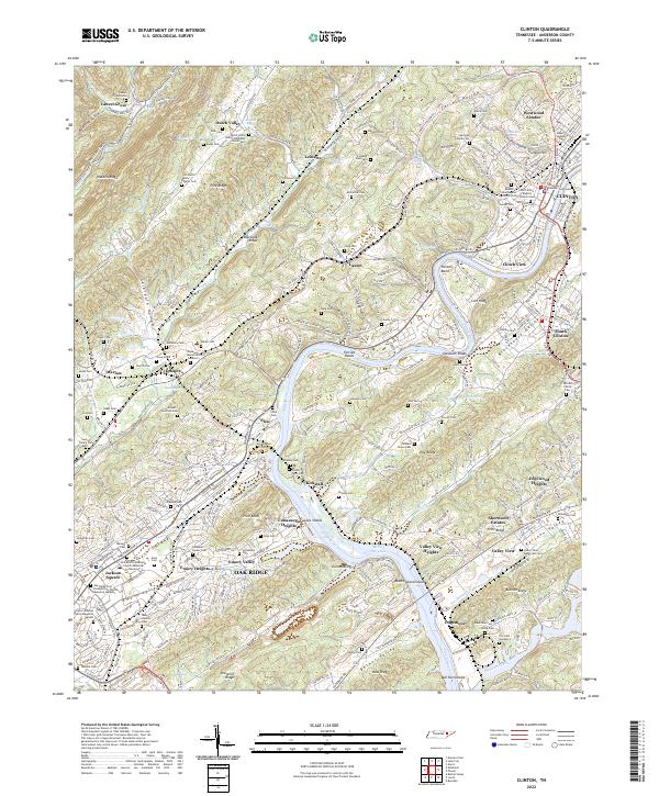
2022 Map of Clinton
USGS Topo · Published 2022About this map
The Anderson County Courthouse stands as the civic center of Clinton, Tennessee, a landscape where the Clinch River carves through a series of parallel ridges and valleys including Walden Ridge and Chestnut Ridge. This modern topographic survey reveals the intricate interface between established riverside communities and the planned development of Oak Ridge, featuring specialized landmarks like Jackson Square and the Unitarian Universalist Church Memorial Garden. The map is particularly dense with genealogical sites, from the Slave Cem near Marlow to the Old Clinton Baptist Church Cem on College Hill. Significant water features such as Melton Hill Lake and the dangerous Florida Shoals illustrate the river's character before and after modern impoundment, while smaller settlements like Elza and Dossett maintain their distinct identities amidst the growing suburban footprint of Westwood Estates and Edgewood Heights.
Find a feature on this map
130 named features on this map. Tap any name to fly to it.
Don’t see what you’re looking for? This feature index may not catch every label — zoom into the map to look around manually.
Map Details
Editions of this 2022 Clinton Map
This is the sole edition of this map. No revisions or reprints were ever made.
Other maps of this area

1893 · Briceville
USGS Topo · 1:125,000

1895 · Loudon
USGS Topo · 1:125,000

1895 · Briceville
USGS Topo · 1:125,000

1896 · Briceville
USGS Topo · 1:125,000

1935 · Bethel Valley
USGS Topo · 1:24,000

1935 · Bearden
USGS Topo · 1:24,000

1935 · Lovell
USGS Topo · 1:24,000

1936 · Duncan Flats
USGS Topo · 1:24,000

1936 · Windrock
USGS Topo · 1:24,000

1936 · Norris Dam
USGS Topo · 1:48,000