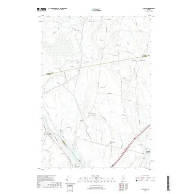
2018 Map of Clinton
USGS Topo · Published 2018About this map
The Kennebec River carves the western boundary of this landscape, where the town of Clinton and the community of Shawmut serve as focal points for local commerce and transport. The river's influence is evident in historical landmarks like the Nobles Ferry Cem, while the interior terrain is defined by the prominent Battle Ridge and Town House Hill. Agriculture and rural life are woven into the geography, with numerous family and community burial grounds such as Evergreen Cem, Wing Cem, and Nyes Corner Cem dotting the countryside.
Find a feature on this map
68 named features on this map. Tap any name to fly to it.
Don’t see what you’re looking for? This feature index may not catch every label — zoom into the map to look around manually.
Map Details
Editions of this 2018 Clinton Map
This is the sole edition of this map. No revisions or reprints were ever made.
Other maps of this area

1892 · Waterville
USGS Topo · 1:62,500

1913 · Skowhegan
USGS Topo · 1:62,500

1926 · Burnham
USGS Topo · 1:62,500

1930 · Pittsfield
USGS Topo · 1:48,000

1932 · Pittsfield
USGS Topo · 1:62,500

1933 · Pittsfield
USGS Topo · 1:62,500

1943 · Waterville
USGS Topo · 1:62,500

1948 · Bangor
USGS Topo · 1:250,000

1955 · Pittsfield
USGS Topo · 1:62,500

1955 · Skowhegan
USGS Topo · 1:62,500