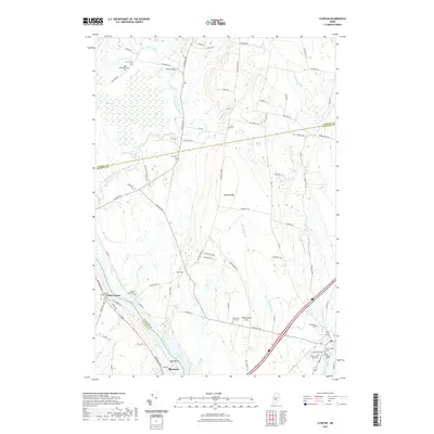
2021 Map of Clinton
USGS Topo · Published 2021About this map
The Kennebec River flows through this modern landscape where the borders of Kennebec and Somerset counties meet. This area is characterized by a high concentration of burial grounds, providing an exceptional resource for genealogical research, with sites ranging from the Nobles Ferry Cem near the river to the Town House Hill Cem further inland. Small settlements like Nyes Corner and Shawmut punctuate the rural terrain, which is defined by the prominent Battle Ridge and the winding paths of Carrabassett Stream and Twelvemile Brook. Historical local movement is reflected in the numerous named roads, such as Horseback Rd and Bellsqueeze Rd, that connect isolated homesteads to the primary thoroughfares like Skowhegan Rd. From the marshy Canaan Bog in the northwest to the industrial corridors near Shawmut, the map documents the persistent agricultural and river-focused character of the region.
Find a feature on this map
77 named features on this map. Tap any name to fly to it.
Don’t see what you’re looking for? This feature index may not catch every label — zoom into the map to look around manually.
Map Details
Editions of this 2021 Clinton Map
This is the sole edition of this map. No revisions or reprints were ever made.
Other maps of this area

1892 · Waterville
USGS Topo · 1:62,500

1913 · Skowhegan
USGS Topo · 1:62,500

1926 · Burnham
USGS Topo · 1:62,500

1930 · Pittsfield
USGS Topo · 1:48,000

1932 · Pittsfield
USGS Topo · 1:62,500

1933 · Pittsfield
USGS Topo · 1:62,500

1943 · Waterville
USGS Topo · 1:62,500

1948 · Bangor
USGS Topo · 1:250,000

1955 · Pittsfield
USGS Topo · 1:62,500

1955 · Skowhegan
USGS Topo · 1:62,500