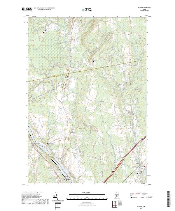
2024 Map of Clinton
USGS Topo · Published 2024About this map
The Kennebec River and Sebasticook River define this central Maine landscape, where the town of Clinton serves as a primary hub for the surrounding rural settlements. The terrain is notably marked by Battle Ridge, a prominent north-south elevation that separates the western drainage of Oak Stream and Carrabassett Stream from the eastern waters of Twelvemile Brook. Historically significant burial grounds are distributed across the countryside, including Nobles Ferry Cem near the river and the Pooler Cem in the north, reflecting generations of family homesteads. The village of Shawmut sits at a strategic bend in the river, while Nyes Corner and Town House Hill represent the traditional crossroads that have anchored local community life. The presence of Canaan Bog in the northwest corner highlights the diverse wetland ecosystems that persist alongside the region's agricultural and residential development.
Find a feature on this map
76 named features on this map. Tap any name to fly to it.
Don’t see what you’re looking for? This feature index may not catch every label — zoom into the map to look around manually.
Map Details
Editions of this 2024 Clinton Map
This is the sole edition of this map. No revisions or reprints were ever made.
Other maps of this area

1892 · Waterville
USGS Topo · 1:62,500

1913 · Skowhegan
USGS Topo · 1:62,500

1926 · Burnham
USGS Topo · 1:62,500

1930 · Pittsfield
USGS Topo · 1:48,000

1932 · Pittsfield
USGS Topo · 1:62,500

1933 · Pittsfield
USGS Topo · 1:62,500

1943 · Waterville
USGS Topo · 1:62,500

1948 · Bangor
USGS Topo · 1:250,000

1955 · Pittsfield
USGS Topo · 1:62,500

1955 · Skowhegan
USGS Topo · 1:62,500