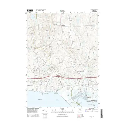
2015 Map of Clinton
USGS Topo · Published 2015About this map
Clinton and Madison anchor this coastal Connecticut landscape, where the Hammonasset River and Indian River flow toward the complex shoreline of Long Island Sound. The transition from the developed coastline to the upland interior is marked by prominent ridges such as Roast Meat Hill and Cow Hill. In the northern reaches, the Hammonasset Reservoir and Killingworth Reservoir dominate the hydrology, reflecting the managed water systems of the mid-20th century.
Find a feature on this map
216 named features on this map. Tap any name to fly to it.
Don’t see what you’re looking for? This feature index may not catch every label — zoom into the map to look around manually.
Map Details
Editions of this 2015 Clinton Map
This is the sole edition of this map. No revisions or reprints were ever made.
Other maps of this area

1893 · Guilford
USGS Topo · 1:62,500

1893 · Saybrook
USGS Topo · 1:62,500

1943 · Durham
USGS Topo · 1:25,000

1944 · Essex
USGS Topo · 1:31,680

1944 · Deep River
USGS Topo · 1:31,680

1947 · Hartford
USGS Topo · 1:250,000

1948 · Hartford
USGS Topo · 1:250,000

1951 · Clinton
USGS Topo · 1:31,680
1952 · Deep River
USGS Topo · 1:31,680

1952 · Haddam
USGS Topo · 1:31,680