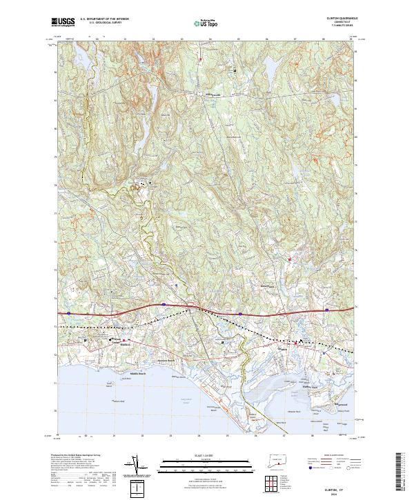
2024 Map of Clinton
USGS Topo · Published 2024About this map
The Hammonasset River forms a natural boundary through this coastal corridor, separating the residential developments and historic centers of Madison Center and Clinton. This shoreline landscape is defined by its transition from the upland hills of Killingworth and Chestnut Hill down to the tidal reaches of Long Island Sound. The map reveals a high density of commemorative sites and preserved spaces, including the Saint Andrews Church Memorial Gardens and multiple historic burial grounds like Old Southwest Cem and Evergreen Cem West. Large-scale public features such as Hammonasset Beach State Park and the Kelseytown Reservoir anchor the eastern and western halves of the sheet, while numerous small ponds like Tuxis Pond and Boulder Lake dot the local topography. The region's transport network is characterized by the modern corridor of Interstate 95 and the Boston Post Road, which bypasses the older clusters at Seaview Beach and Harbor View.
Find a feature on this map
194 named features on this map. Tap any name to fly to it.
Don’t see what you’re looking for? This feature index may not catch every label — zoom into the map to look around manually.
Map Details
Editions of this 2024 Clinton Map
This is the sole edition of this map. No revisions or reprints were ever made.
Other maps of this area

1893 · Guilford
USGS Topo · 1:62,500

1893 · Saybrook
USGS Topo · 1:62,500

1943 · Durham
USGS Topo · 1:25,000

1944 · Essex
USGS Topo · 1:31,680

1944 · Deep River
USGS Topo · 1:31,680

1947 · Hartford
USGS Topo · 1:250,000

1948 · Hartford
USGS Topo · 1:250,000

1951 · Clinton
USGS Topo · 1:31,680
1952 · Deep River
USGS Topo · 1:31,680

1952 · Haddam
USGS Topo · 1:31,680