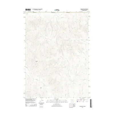
2014 Map of Clinton NW
USGS Topo · Published 2014About this map
Rattlesnake Peak and Mt Maria dominate this section of the High Plains along the border of Nebraska and South Dakota. This 2014 survey by the U.S. Geological Survey documents a landscape shaped by intermittent drainage systems and rural access routes. The terrain is defined by the winding paths of S Prong Wolf Cr, Patton Cr, and Larrabee Cr, which carve through the topographical elevations of Sheridan County. Water management in this arid environment is represented by the Otte Reservoir in the eastern portion of the quadrangle. A network of section-line roads and trails, such as 760th TRL and 325th TRL, provide the primary infrastructure for ranching and land management in this sparsely populated borderland region.
Find a feature on this map
13 named features on this map. Tap any name to fly to it.
Don’t see what you’re looking for? This feature index may not catch every label — zoom into the map to look around manually.
Map Details
Editions of this 2014 Clinton NW Map
This is the sole edition of this map. No revisions or reprints were ever made.
Other maps of this area

1955 · Hot Springs
USGS Topo · 1:250,000

1955 · Alliance
USGS Topo · 1:250,000

1957 · Alliance
USGS Topo · 1:250,000

1958 · Alliance
USGS Topo · 1:250,000

1967 · Pine Ridge
USGS Topo · 1:24,000

1967 · Manderson SW
USGS Topo · 1:24,000

1967 · Denby
USGS Topo · 1:24,000

1969 · Clinton
USGS Topo · 1:24,000

1969 · Whiteclay
USGS Topo · 1:24,000

1969 · Clinton NW
USGS Topo · 1:24,000