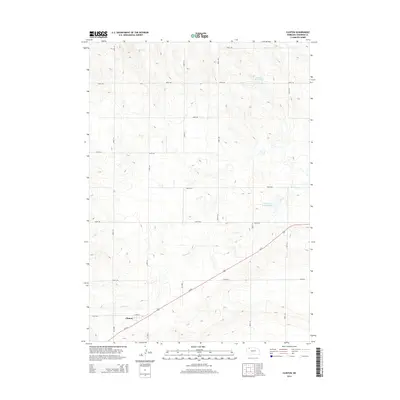
2014 Map of Clinton
USGS Topo · Published 2014About this map
Clinton sits at the intersection of local history and transcontinental transit in this northern Sheridan County landscape. The community's small grid, anchored by Love St, is bisected by the prominent corridor of Us-20. This route serves as a primary artery across the Sandhills region, connecting the settlement to the surrounding agricultural patchwork. The terrain is defined by a dense network of section-line roads such as 700th Rd and 280th Ln, reflecting the systematic division of the High Plains. Hydrological management is central to the area's utility, with Antelope Creek winding through the pastures to feed the Antelope Cr Reservoir 60-A. To the north, Johnson Reservoir provides a significant water landmark amidst the rhythmic contour lines of the Nebraska panhandle.
Find a feature on this map
20 named features on this map. Tap any name to fly to it.
Don’t see what you’re looking for? This feature index may not catch every label — zoom into the map to look around manually.
Map Details
Editions of this 2014 Clinton Map
This is the sole edition of this map. No revisions or reprints were ever made.
Other maps of this area

1955 · Alliance
USGS Topo · 1:250,000

1957 · Alliance
USGS Topo · 1:250,000

1958 · Alliance
USGS Topo · 1:250,000

1966 · Rushville
USGS Topo · 1:24,000

1969 · Gordon
USGS Topo · 1:24,000

1969 · Clinton
USGS Topo · 1:24,000

1969 · Clinton NW
USGS Topo · 1:24,000

1969 · Clinton NE
USGS Topo · 1:24,000

1969 · Clinton SW
USGS Topo · 1:24,000
1969 · Rushville 4 NW
USGS Topo · 1:24,000