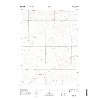
2017 Map of Clinton
USGS Topo · Published 2017About this map
The small settlement of Clinton serves as the primary landmark in this Sheridan County landscape, situated along the southern edge of a vast network of section roads and drainage basins. The terrain is defined by the winding course of Antelope Cr, which feeds into specialized water management features such as Antelope Cr Reservoir 60-A. To the northeast, the presence of Johnson Reservoir indicates the critical importance of water storage in this agricultural region. The map reveals a strictly organized rural grid, where routes like 280th Ln and 690th Rd facilitate movement across the rolling plains. This 2017 survey by the U.S. Geological Survey captures the enduring structure of Nebraska's Sandhills edge, where modern naming conventions for roads like 250th Trl and 630th Rd overlay the historic Public Land Survey System township and range divisions.
Find a feature on this map
33 named features on this map. Tap any name to fly to it.
Don’t see what you’re looking for? This feature index may not catch every label — zoom into the map to look around manually.
Map Details
Editions of this 2017 Clinton Map
This is the sole edition of this map. No revisions or reprints were ever made.
Other maps of this area

1955 · Alliance
USGS Topo · 1:250,000

1957 · Alliance
USGS Topo · 1:250,000

1958 · Alliance
USGS Topo · 1:250,000

1966 · Rushville
USGS Topo · 1:24,000

1969 · Gordon
USGS Topo · 1:24,000

1969 · Clinton
USGS Topo · 1:24,000

1969 · Clinton NW
USGS Topo · 1:24,000

1969 · Clinton NE
USGS Topo · 1:24,000

1969 · Clinton SW
USGS Topo · 1:24,000
1969 · Rushville 4 NW
USGS Topo · 1:24,000