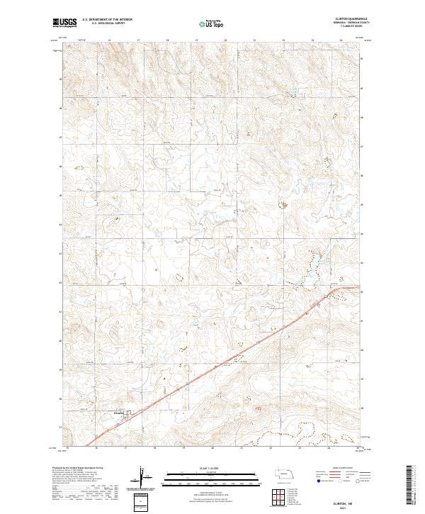
2021 Map of Clinton
USGS Topo · Published 2021About this map
Clinton sits at the southern edge of this Sheridan County landscape, where the local road network gives way to the open terrain of the Nebraska panhandle. The settlement is defined by its position along the Cowboy Trl, a long-distance corridor that follows the path of former rail infrastructure through the region. This 2021 survey highlights a transition from the structured grid of rural section roads, such as 690th Rd and 650th Rd, to the more organic drainage patterns of the Sandhills. Water management is central to the area's geography, evidenced by the Johnson Reservoir in the northeast and the Antelope Cr Reservoir 60-A which captures flow from Antelope Cr. The map provides a clear look at contemporary land divisions and the sparse but critical infrastructure supporting this ranching and agricultural community.
Find a feature on this map
27 named features on this map. Tap any name to fly to it.
Don’t see what you’re looking for? This feature index may not catch every label — zoom into the map to look around manually.
Map Details
Editions of this 2021 Clinton Map
This is the sole edition of this map. No revisions or reprints were ever made.
Other maps of this area

1955 · Alliance
USGS Topo · 1:250,000

1957 · Alliance
USGS Topo · 1:250,000

1958 · Alliance
USGS Topo · 1:250,000

1966 · Rushville
USGS Topo · 1:24,000

1969 · Gordon
USGS Topo · 1:24,000

1969 · Clinton
USGS Topo · 1:24,000

1969 · Clinton NW
USGS Topo · 1:24,000

1969 · Clinton NE
USGS Topo · 1:24,000

1969 · Clinton SW
USGS Topo · 1:24,000
1969 · Rushville 4 NW
USGS Topo · 1:24,000