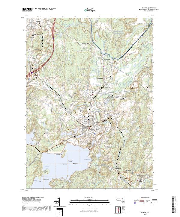
2024 Map of Clinton
USGS Topo · Published 2024About this map
The Wachusett Reservoir dominates the southern landscape of this central Massachusetts region, serving as a massive hydraulic anchor for the surrounding communities of Clinton, Boylston, and Berlin. This 2024 survey documents a complex network of historic burial sites and institutional grounds, notably the Old Common Burial Ground and the specialized Lancaster Industrial School for Girls Cem. Educational and industrial history is represented by Atlantic Union College and the naming of Ponakin Mill along the North Nashua River. Modern infrastructure and conservation efforts appear side-by-side, from the Cosgrove Aqueduct to the protected wetlands of the Oxbow National Wildlife Refuge. The map also traces the conversion of historic rail corridors into recreational assets, such as the Mass-Central/Wayside Rail Trl.
Find a feature on this map
74 named features on this map. Tap any name to fly to it.
Don’t see what you’re looking for? This feature index may not catch every label — zoom into the map to look around manually.
Map Details
Editions of this 2024 Clinton Map
This is the sole edition of this map. No revisions or reprints were ever made.
Other maps of this area

1885 · Worcester
USGS Topo · 1:62,500

1886 · Worcester
USGS Topo · 1:62,500

1887 · Marlboro
USGS Topo · 1:62,500

1887 · Fitchburg
USGS Topo · 1:62,500

1889 · Marlboro
USGS Topo · 1:62,500

1889 · Fitchburg
USGS Topo · 1:62,500

1892 · Worcester
USGS Topo · 1:62,500

1893 · Fitchburg
USGS Topo · 1:62,500

1893 · Groton
USGS Topo · 1:62,500

1896 · Marlboro
USGS Topo · 1:62,500