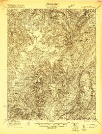
1921 Map of Clintonville
USGS Topo · Published 1921About this map
The James River and Kanawha Turnpike cuts across this Greenbrier County landscape, tracing a historic transportation corridor through the Meadow Bluff District and Blue Sulphur District. During this early 1920s survey, the area was defined by a dense network of country schoolhouses and community churches, such as Maude Chapel and the Black Church, serving decentralized agricultural settlements.
Find a feature on this map
84 named features on this map. Tap any name to fly to it.
Don’t see what you’re looking for? This feature index may not catch every label — zoom into the map to look around manually.
Map Details
Editions of this 1921 Clintonville Map
This is the sole edition of this map. No revisions or reprints were ever made.
Other maps of this area

1887 · Hinton
USGS Topo · 1:125,000

1887 · Lewisburg
USGS Topo · 1:125,000

1889 · Nicholas
USGS Topo · 1:125,000

1891 · Lewisburg
USGS Topo · 1:125,000

1891 · Nicholas
USGS Topo · 1:125,000

1891 · Huntersville
USGS Topo · 1:125,000

1892 · Hinton
USGS Topo · 1:125,000

1894 · Huntersville
USGS Topo · 1:125,000

1901 · Nicholas
USGS Topo · 1:125,000
1912 · Meadow Creek
USGS Topo · 1:48,000