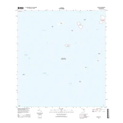
2015 Map of Clive Key
USGS Topo · Published 2015About this map
Everglades National Park encompasses this maritime landscape of the Florida Bay, where a network of shallow basins and banks defines the coastal environment. The map highlights the complex hydrography of the region, including the Joe Kemp Channel and Conchie Channel, which serve as critical passages through the submerged flats. Scattered throughout the Atlantic Ocean waters are several named islands, such as Murray Key, Frank Key, and the centrally located Clive Key.
Find a feature on this map
27 named features on this map. Tap any name to fly to it.
Don’t see what you’re looking for? This feature index may not catch every label — zoom into the map to look around manually.
Map Details
Editions of this 2015 Clive Key Map
This is the sole edition of this map. No revisions or reprints were ever made.
Other maps of this area

1956 · Miami
USGS Topo · 1:250,000

1958 · Miami
USGS Topo · 1:250,000

1972 · Schooner Bank
USGS Topo · 1:24,000

1972 · East Bahia Honda Key NE
USGS Topo · 1:24,000

1972 · Lake Ingraham East
USGS Topo · 1:24,000

1972 · Pelican Keys
USGS Topo · 1:24,000

1972 · West Lake
USGS Topo · 1:24,000

1972 · Sandy Key
USGS Topo · 1:24,000

1972 · Buchanan Keys
USGS Topo · 1:24,000

1972 · Clive Key
USGS Topo · 1:24,000