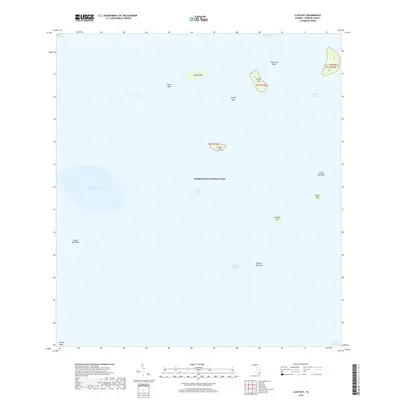
2018 Map of Clive Key
USGS Topo · Published 2018About this map
Florida Bay dominates this coastal landscape within Everglades National Park, where the shifting boundaries of land and water are defined by a series of mangrove keys and underwater banks. Named islands like Palm Key and Clive Key are scattered across the shallow waters, providing essential navigation points in an environment where land is often just feet above sea level. This 2018 survey reveals the intricate hydrography of the region, including the Conchie Channel and Joe Kemp Channel, which weave through submerged features such as Dave Foy Bank and Oxfoot Bank. The map details the transition from the open bay to protected basins like the Sandy Key Basin and Rabbit Key Basin, illustrating the unique geological formation of the Everglades wilderness. It serves as a precise record of these fragile coastal landforms and their naming conventions, from the distinctive Dildo Key to the secluded Man of War Key.
Find a feature on this map
25 named features on this map. Tap any name to fly to it.
Don’t see what you’re looking for? This feature index may not catch every label — zoom into the map to look around manually.
Map Details
Editions of this 2018 Clive Key Map
This is the sole edition of this map. No revisions or reprints were ever made.
Other maps of this area

1956 · Miami
USGS Topo · 1:250,000

1958 · Miami
USGS Topo · 1:250,000

1972 · Schooner Bank
USGS Topo · 1:24,000

1972 · East Bahia Honda Key NE
USGS Topo · 1:24,000

1972 · Lake Ingraham East
USGS Topo · 1:24,000

1972 · Pelican Keys
USGS Topo · 1:24,000

1972 · West Lake
USGS Topo · 1:24,000

1972 · Sandy Key
USGS Topo · 1:24,000

1972 · Buchanan Keys
USGS Topo · 1:24,000

1972 · Clive Key
USGS Topo · 1:24,000