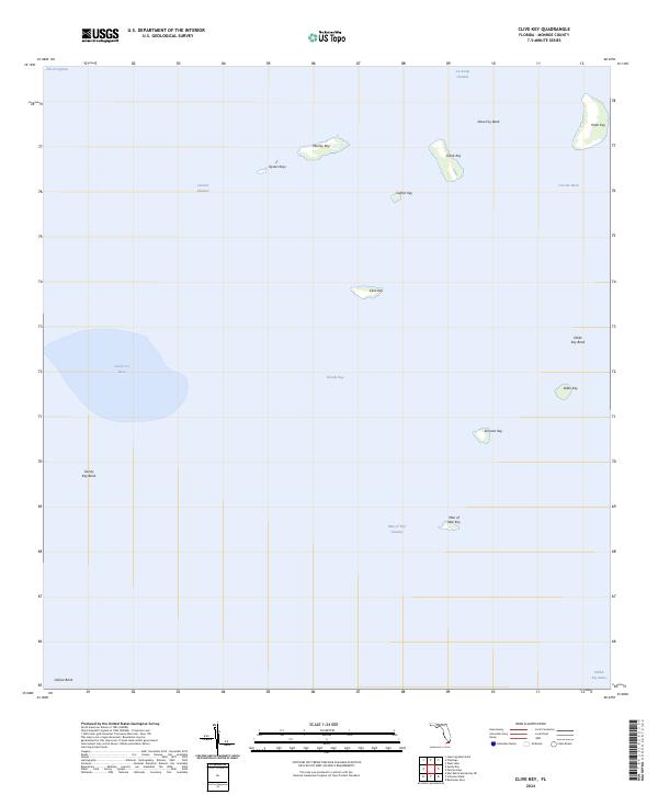
2024 Map of Clive Key
USGS Topo · Published 2024About this map
The Everglades reach their southern aquatic boundary here, where the mainland gives way to the shallow, island-dotted expanse of Florida Bay. This maritime landscape is defined by a network of mangrove keys and submerged banks that dictate navigation through the shifting shallows. Wide, protected waters like Sandy Key Basin and Conchie Basin are separated by treacherous flats such as Dave Foy Bank and Sandy Key Bank, illustrating the delicate transition between the open gulf and the inner bay.
Find a feature on this map
25 named features on this map. Tap any name to fly to it.
Don’t see what you’re looking for? This feature index may not catch every label — zoom into the map to look around manually.
Map Details
Editions of this 2024 Clive Key Map
This is the sole edition of this map. No revisions or reprints were ever made.
Other maps of this area

1956 · Miami
USGS Topo · 1:250,000

1958 · Miami
USGS Topo · 1:250,000

1972 · Schooner Bank
USGS Topo · 1:24,000

1972 · East Bahia Honda Key NE
USGS Topo · 1:24,000

1972 · Lake Ingraham East
USGS Topo · 1:24,000

1972 · Pelican Keys
USGS Topo · 1:24,000

1972 · West Lake
USGS Topo · 1:24,000

1972 · Sandy Key
USGS Topo · 1:24,000

1972 · Buchanan Keys
USGS Topo · 1:24,000

1972 · Clive Key
USGS Topo · 1:24,000