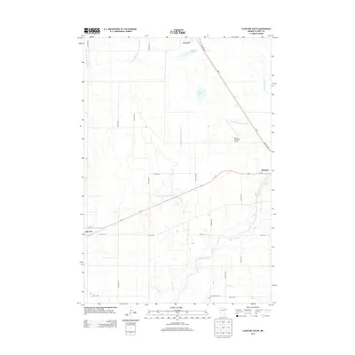
2013 Map of Clontarf South
USGS Topo · Published 2013About this map
The Chippewa River winds through this agricultural portion of Swift County, anchoring a landscape defined by an extensive network of water management systems. This 2013 survey illustrates the modern configuration of the prairie, where established settlements like Benson and Clontarf are connected by major transit corridors including Us-12 and MN-9. The map details the region's managed hydrology, featuring engineered watercourses such as Judicial Ditch Number Eighty and County Ditch Number Seven. Local history and genealogy are preserved at the Six Mile Grove Cem in the southern section of the quadrangle, while the presence of the Benson Municipal Airport reflects the area's contemporary infrastructure. Natural prairie depressions are still visible in the forms of Lynch Lake and Malachy Lake, providing a contrast to the geometric precision of the township road grid and the diagonal path of the regional highways.
Find a feature on this map
28 named features on this map. Tap any name to fly to it.
Don’t see what you’re looking for? This feature index may not catch every label — zoom into the map to look around manually.
Map Details
Editions of this 2013 Clontarf South Map
This is the sole edition of this map. No revisions or reprints were ever made.
Other maps of this area

1953 · Saint Cloud
USGS Topo · 1:250,000

1957 · Saint Cloud
USGS Topo · 1:250,000

1958 · Saint Cloud
USGS Topo · 1:250,000

1958 · Gracelock NE
USGS Topo · 1:24,000

1958 · Big Bend City
USGS Topo · 1:24,000

1958 · Gracelock NW
USGS Topo · 1:24,000

1968 · Danvers
USGS Topo · 1:24,000

1968 · Hancock
USGS Topo · 1:24,000

1968 · Lake Hassel
USGS Topo · 1:24,000

1968 · Benson
USGS Topo · 1:24,000