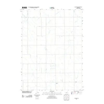
2011 Map of Closter
USGS Topo · Published 2011About this map
Closter is situated in a high plains agricultural landscape defined by a precise section-line road network and several drainages that feed the Platte River watershed. The geography is etched by the meandering courses of Saint Clair Creek, Ives Creek, and Blacksnake Creek, which break the regularity of the surrounding farm grid. This 2011 survey illustrates the rural character of Boone County, where the built environment is largely limited to isolated farmsteads and small clusters of activity along routes like 839th Rd and 527th Ave. One of the most significant historical markers for genealogists and local historians is the Zion West Cemetery, located in the southern portion of the quadrangle. The map further documents the upper reaches of North Shell Creek, capturing the area's hydrology and land-use patterns in the early twenty-first century.
Find a feature on this map
17 named features on this map. Tap any name to fly to it.
Don’t see what you’re looking for? This feature index may not catch every label — zoom into the map to look around manually.
Map Details
Editions of this 2011 Closter Map
This is the sole edition of this map. No revisions or reprints were ever made.
Other maps of this area

1955 · Broken Bow
USGS Topo · 1:250,000

1955 · Sioux City
USGS Topo · 1:250,000

1955 · Fremont
USGS Topo · 1:250,000

1955 · O'Neill
USGS Topo · 1:250,000

1956 · Broken Bow
USGS Topo · 1:250,000

1957 · Fremont
USGS Topo · 1:250,000

1958 · Sioux City
USGS Topo · 1:250,000

1958 · Fremont
USGS Topo · 1:250,000

1959 · O'Neill
USGS Topo · 1:250,000

1959 · Sioux City
USGS Topo · 1:250,000