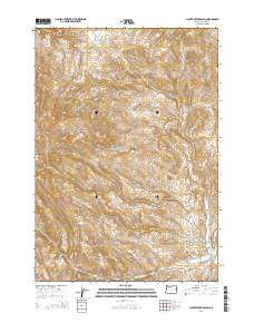
2014 Map of Clover Creek Ranch
USGS Topo · Published 2014About this map
Ferriers Gulch and the high drainage basins of Malheur County define this high-desert landscape as it appeared in the early 21st century. The map traces a complex network of seasonal watercourses, including Post Cr and Spaulding Cr, which cut through the steep topography of the region. The primary human imprint on this area is represented by Bonita Rd in the southeastern corner, while the remainder of the territory is characterized by its drainage patterns and named terrain features like Brushy Hollow.
Find a feature on this map
13 named features on this map. Tap any name to fly to it.
Don’t see what you’re looking for? This feature index may not catch every label — zoom into the map to look around manually.
Map Details
Editions of this 2014 Clover Creek Ranch Map
This is the sole edition of this map. No revisions or reprints were ever made.
Other maps of this area

1908 · Ironside Mountain
USGS Topo · 1:125,000

1955 · Baker
USGS Topo · 1:250,000

1955 · Canyon City
USGS Topo · 1:250,000

1959 · Baker
USGS Topo · 1:250,000

1959 · Canyon City
USGS Topo · 1:250,000

1964 · Ironside
USGS Topo · 1:62,500

1966 · Clover Creek Ranch
USGS Topo · 1:62,500

1970 · Castle Rock
USGS Topo · 1:62,500
1972 · Eldorado Pass
USGS Topo · 1:24,000

1978 · John Day
USGS Topo · 1:100,000