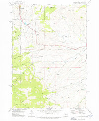
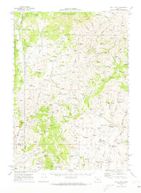
1972 Map of Eldorado Pass
USGS Topo · Published 1976About this map
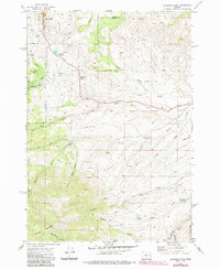
Eldorado Pass serves as a central divide in this high-desert landscape of eastern Oregon, where the headwaters of numerous creeks diverge across the Baker and Malheur County line. The terrain is defined by its complex drainage network, including North Willow Creek, Middle Willow Creek, and South Willow Creek, which carve through the high country surrounding Ironside Mountain. Evidence of land management and historical boundaries is prominent, from the Old Indian Reservation Boundary cutting across the center of the sheet to the Whitman National Forest land in the west. Small-scale water infrastructure like Murray Reservoir and High Horn Reservoir supports the ranching character of the area, further evidenced by the Ironside C&H Corrals. A remote Landing Strip and various Jeep Trails provide the only significant access through these canyons and gulches, such as Black Stump Canyon and Lake Gulch.
Find a feature on this map
39 named features on this map. Tap any name to fly to it.
Don’t see what you’re looking for? This feature index may not catch every label — zoom into the map to look around manually.
Map Details
Editions of this 1972 Eldorado Pass Map
2 editions found
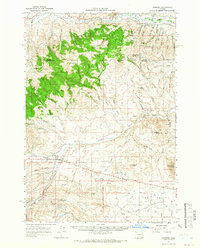
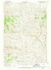
Other maps of this area

1908 · Ironside Mountain
USGS Topo · 1:125,000

1955 · Baker
USGS Topo · 1:250,000

1955 · Canyon City
USGS Topo · 1:250,000

1959 · Baker
USGS Topo · 1:250,000

1959 · Canyon City
USGS Topo · 1:250,000
1964 · Ironside
USGS Topo · 1:62,500
1966 · Clover Creek Ranch
USGS Topo · 1:62,500
1970 · Castle Rock
USGS Topo · 1:62,500

1972 · Hereford
USGS Topo · 1:24,000
1972 · Unity
USGS Topo · 1:24,000