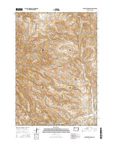
2017 Map of Clover Creek Ranch
USGS Topo · Published 2017About this map
Clover Creek Ranch anchors the southeastern corner of this Malheur County landscape, situated near the intersection of Wheaton Cr and Clover Cr. The terrain is defined by a dense network of drainages including N Clover Cr, Spaulding Cr, and Post Cr, which flow through the high-elevation breaks of the high desert. Local movement through this area is facilitated by a few key thoroughfares such as Belknapp Rd, Upper Clover Creek Rd, and Bonita Rd.
Find a feature on this map
16 named features on this map. Tap any name to fly to it.
Don’t see what you’re looking for? This feature index may not catch every label — zoom into the map to look around manually.
Map Details
Editions of this 2017 Clover Creek Ranch Map
This is the sole edition of this map. No revisions or reprints were ever made.
Other maps of this area

1908 · Ironside Mountain
USGS Topo · 1:125,000

1955 · Baker
USGS Topo · 1:250,000

1955 · Canyon City
USGS Topo · 1:250,000

1959 · Baker
USGS Topo · 1:250,000

1959 · Canyon City
USGS Topo · 1:250,000

1964 · Ironside
USGS Topo · 1:62,500

1966 · Clover Creek Ranch
USGS Topo · 1:62,500

1970 · Castle Rock
USGS Topo · 1:62,500
1972 · Eldorado Pass
USGS Topo · 1:24,000

1978 · John Day
USGS Topo · 1:100,000