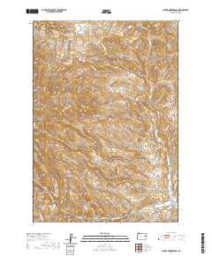
2020 Map of Clover Creek Ranch
USGS Topo · Published 2020About this map
Clover Creek Ranch sits at the base of a high-elevation drainage system in Malheur County, where the southern flow of Clover Cr and Smith Cr meets the remote transport corridor of Belknapp Rd. This landscape is defined by its complex network of seasonal and perennial waterways, including Spaulding Cr and Post Cr, which carve through the high desert terrain. The area's geography is punctuated by significant natural features such as Ferriers Gulch in the northwest and Brushy Hollow in the southeast. This survey reflects the modern infrastructure supporting rural ranching life, tracing the essential connection between water sources and the local road network, including Upper Clover Creek Rd and Bonita Rd.
Find a feature on this map
16 named features on this map. Tap any name to fly to it.
Don’t see what you’re looking for? This feature index may not catch every label — zoom into the map to look around manually.
Map Details
Editions of this 2020 Clover Creek Ranch Map
This is the sole edition of this map. No revisions or reprints were ever made.
Other maps of this area

1908 · Ironside Mountain
USGS Topo · 1:125,000

1955 · Baker
USGS Topo · 1:250,000

1955 · Canyon City
USGS Topo · 1:250,000

1959 · Baker
USGS Topo · 1:250,000

1959 · Canyon City
USGS Topo · 1:250,000

1964 · Ironside
USGS Topo · 1:62,500

1966 · Clover Creek Ranch
USGS Topo · 1:62,500

1970 · Castle Rock
USGS Topo · 1:62,500
1972 · Eldorado Pass
USGS Topo · 1:24,000

1978 · John Day
USGS Topo · 1:100,000