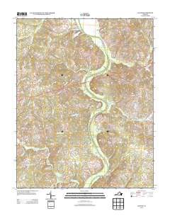
2013 Map of Clover
USGS Topo · Published 2013About this map
The Roanoke River snakes through this rural corner of Halifax County, defining the landscape and historical transportation patterns of the region. The settlement of Clover serves as a primary hub on the western edge of the map, while Public Fork occupies a central position to the east. The river's historical importance is underscored by several thoroughfares leading to former crossing points, including Mosely Ferry Rd and Colemans Ferry Rd, reflecting an era when ferries were vital for regional connectivity.
Find a feature on this map
80 named features on this map. Tap any name to fly to it.
Don’t see what you’re looking for? This feature index may not catch every label — zoom into the map to look around manually.
Map Details
Editions of this 2013 Clover Map
This is the sole edition of this map. No revisions or reprints were ever made.
Other maps of this area

1941 · Clarksville
USGS Topo · 1:48,000

1943 · Clarksville
USGS Topo · 1:62,500

1953 · South Boston
USGS Topo · 1:62,500

1953 · Greensboro
USGS Topo · 1:250,000

1954 · Greensboro
USGS Topo · 1:250,000

1954 · Clover
USGS Topo · 1:62,500

1954 · Halifax
USGS Topo · 1:62,500

1957 · South Boston
USGS Topo · 1:62,500

1957 · Clarksville
USGS Topo · 1:62,500

1962 · Greensboro
USGS Topo · 1:250,000