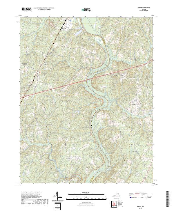
2022 Map of Clover
USGS Topo · Published 2022About this map
The Roanoke River snakes across the landscape of Halifax and Charlotte counties, defining the geography of the Clover vicinity. This modern mapping of the region highlights a transition in land use, where former rail corridors have been repurposed into the Tobacco Heritage Trl, which now winds through the drainage basins of Black Walnut Cr and Buffalo Cr. The settlement of Clover serves as a local hub, anchored by its grid of streets such as Delaware St and Magnolia St, and the nearby Saint Matthews Baptist Church with its adjacent Cem.
Find a feature on this map
84 named features on this map. Tap any name to fly to it.
Don’t see what you’re looking for? This feature index may not catch every label — zoom into the map to look around manually.
Map Details
Editions of this 2022 Clover Map
This is the sole edition of this map. No revisions or reprints were ever made.
Other maps of this area

1941 · Clarksville
USGS Topo · 1:48,000

1943 · Clarksville
USGS Topo · 1:62,500

1953 · South Boston
USGS Topo · 1:62,500

1953 · Greensboro
USGS Topo · 1:250,000

1954 · Greensboro
USGS Topo · 1:250,000

1954 · Clover
USGS Topo · 1:62,500

1954 · Halifax
USGS Topo · 1:62,500

1957 · South Boston
USGS Topo · 1:62,500

1957 · Clarksville
USGS Topo · 1:62,500

1962 · Greensboro
USGS Topo · 1:250,000