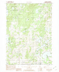
1982 Map of Cloverdale
USGS Topo · Published 1982About this map
The Yankee Springs State Recreation Area and Barry State Game Area dominate this landscape, illustrating the preservation of public lands in Barry County during the early 1980s. The region is defined by a dense concentration of glacial kettle lakes, including Gun Lake, Wall Lake, and the marshy edges of Wilkinson Lake. These water bodies are surrounded by small, historic settlements like Cloverdale and Prairieville, which grew around early township crossroads. Local history is etched into the landscape at sites like the Jesuit Cem near Snow Lake and the McCallum Ch further east. The map captures a moment when traditional rural life, evidenced by the Brush Ridge Cem and family-named roads like Waldorff Road, coexisted with modern educational and recreational sites like the Circle Pine Center and the growing residential cluster at Delton.
Find a feature on this map
63 named features on this map. Tap any name to fly to it.
Don’t see what you’re looking for? This feature index may not catch every label — zoom into the map to look around manually.
Map Details
Editions of this 1982 Cloverdale Map
2 editions found
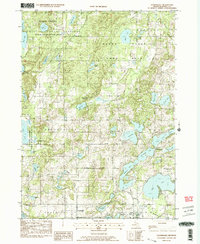
Other maps of this area

1916 · Kalamazoo
USGS Topo · 1:62,500

1918 · Kalamazoo
USGS Topo · 1:62,500

1918 · Galesburg
USGS Topo · 1:62,500

1943 · Kalamazoo
USGS Topo · 1:62,500

1944 · Galesburg
USGS Topo · 1:62,500

1947 · Delton
USGS Topo · 1:24,000

1947 · Banfield
USGS Topo · 1:24,000

1947 · Galesburg
USGS Topo · 1:62,500

1950 · Galesburg
USGS Topo · 1:62,500

1951 · Hastings
USGS Topo · 1:62,500
Featured Places
- Prairieville, MI
- Circle Pines Center, MI
- Prairieville Township, MI
- Orangeville Township, MI
- Hope Township, MI