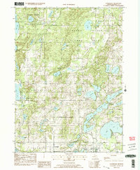
1982 Map of Cloverdale
USGS Topo · Published 1982About this map
Cloverdale and Prairieville anchor this map of Barry County, which is defined by an intricate glacial landscape of kettle lakes and sprawling wetlands. The northwestern portion is dominated by the Yankee Springs State Recreation Area and the Barry State Game Area, illustrating a transition toward conservation and public land use by the early 1980s. Local history is deeply rooted here, visible in landmarks such as the Jesuit Cem near Snow Lake and the Yankee Springs Ch. Small crossroads and community hubs like Delton and the Circle Pine Center provide a look at the rural settlement patterns between the townships of Orangeville and Hope. Water bodies of every scale, from the massive Gun Lake to the secluded Blackman Swamp, suggest a region historically and economically tied to fishing and seasonal recreation.
Find a feature on this map
50 named features on this map. Tap any name to fly to it.
Don’t see what you’re looking for? This feature index may not catch every label — zoom into the map to look around manually.
Map Details
Editions of this 1982 Cloverdale Map
2 editions found
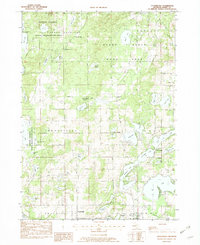
Other maps of this area

1916 · Kalamazoo
USGS Topo · 1:62,500

1918 · Kalamazoo
USGS Topo · 1:62,500

1918 · Galesburg
USGS Topo · 1:62,500

1943 · Kalamazoo
USGS Topo · 1:62,500

1944 · Galesburg
USGS Topo · 1:62,500

1947 · Delton
USGS Topo · 1:24,000

1947 · Banfield
USGS Topo · 1:24,000

1947 · Galesburg
USGS Topo · 1:62,500

1950 · Galesburg
USGS Topo · 1:62,500

1951 · Hastings
USGS Topo · 1:62,500
Featured Places
- Prairieville, MI
- Circle Pines Center, MI
- Prairieville Township, MI
- Orangeville Township, MI
- Hope Township, MI